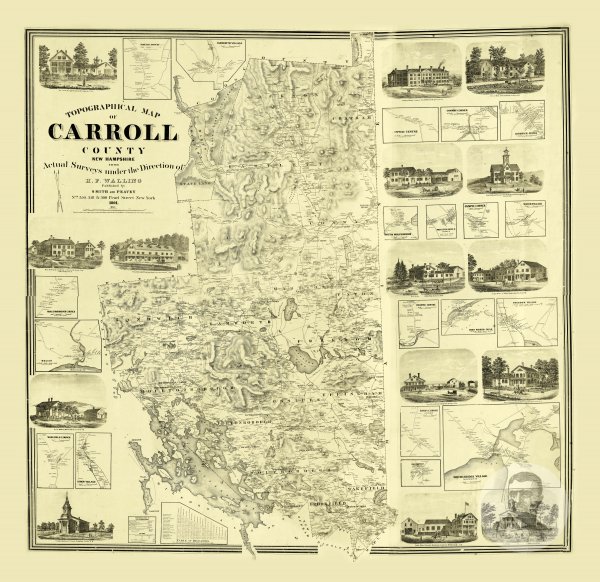
Carroll County, New Hampshire 1861 Map
Like
Comment
Share
Carroll County, New Hampshire 1861 Map


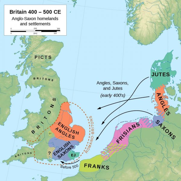
The Migration of the Angles and Saxons to Britain in the 5th c. AD.
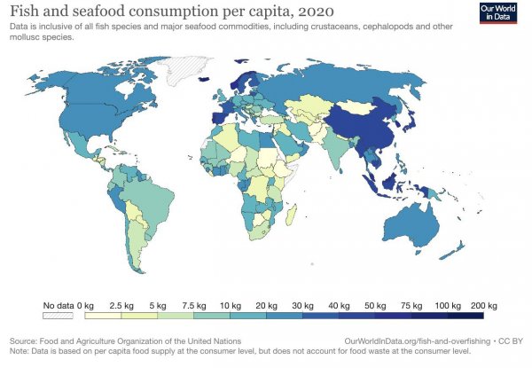
Fish and seafood consumption around the world
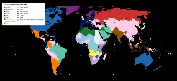
Countries by currency
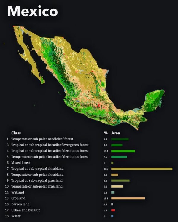
Map of the vegetation and biome coverage of Mexico.
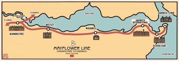
[OC] A Map of the Mayflower Line, Essex
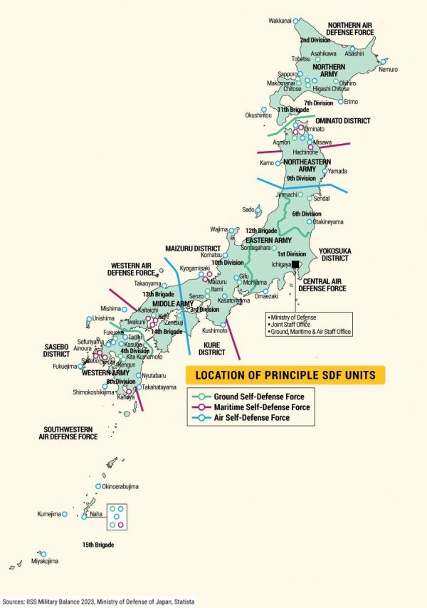
Positioning of principle Japan Self-Defense Forces (SDF)
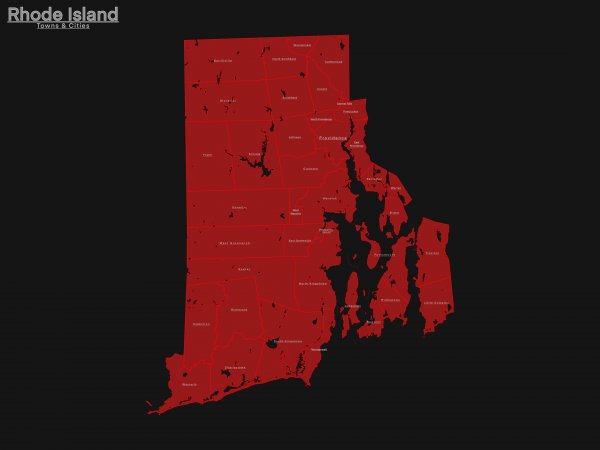
Town & City Map of Rhode Island
What about it?
I made this for fun
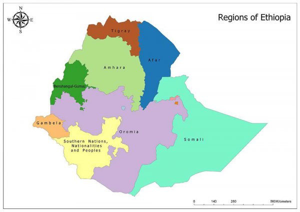
A Map of Ethiopias ethnic based federal states.
What about it?
A map of Ethiopias ethnic federal states. Each region has its own military, parliament and president. They are basically mini nations inside of Ethiopia. Lately the central government have been in & out of war with the regions, it wouldn’t be a surprise if some of these regions declared independence. The central government is launching a war against the Amhara right now and they just came out of war against Tigray. The Nobel peace prize president of Ethiopia has not delivered the promise of a free and prosperous country.
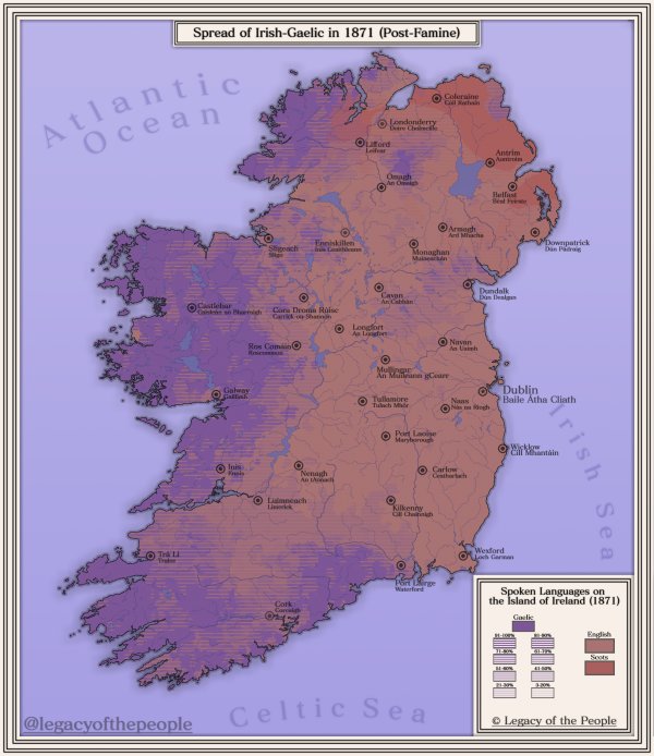
Spread of the Irish Language in 1871
Centered at 23.7267° N, 90.4213° E and 20 km distance on both side. Don't know if it covers the entire Dhaka or not.