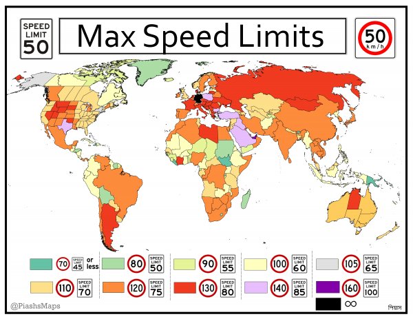
Max Speed Limits Around the World
Like
Comment
Share
Max Speed Limits Around the World


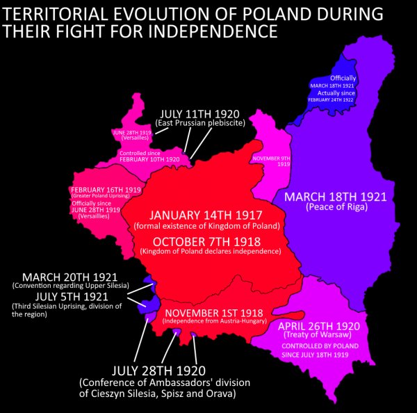
Territorial evolution of Poland since it's formation in 1917 by the Central Powers until 1922 - the shape we recognise today.
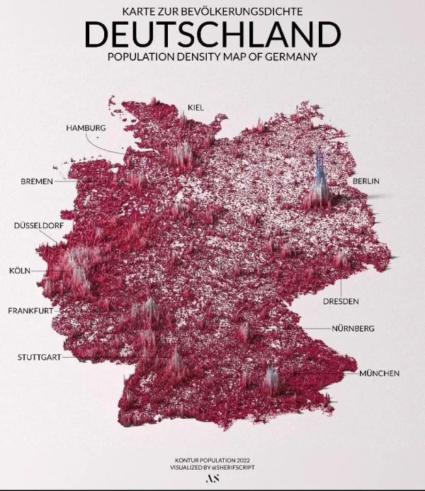
Population density of Germany
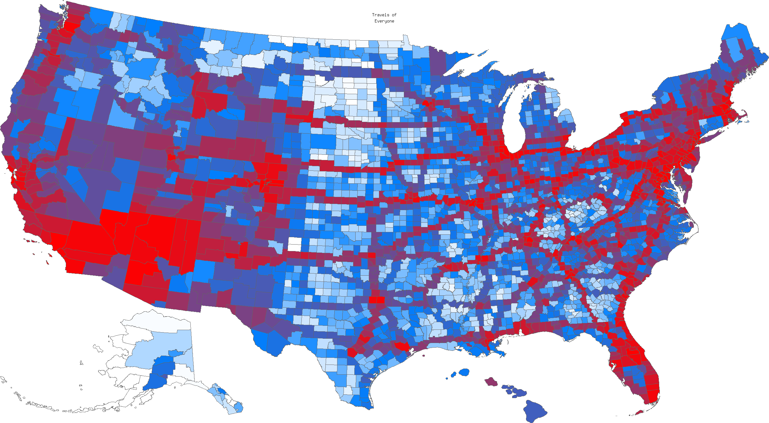
Most heavily visited counties of the US (according to mob-rule.com)
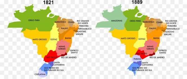
Empire of Brazil (1821-1889)
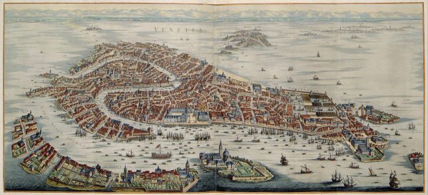
A map of Venice in 1636 by Joan Blaeu [2500 x 1144]
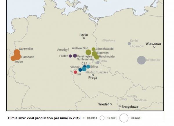
Coal mines in Central Europe. I will leave this for others to decide are attacks on Turow mine by EU political or genuine.
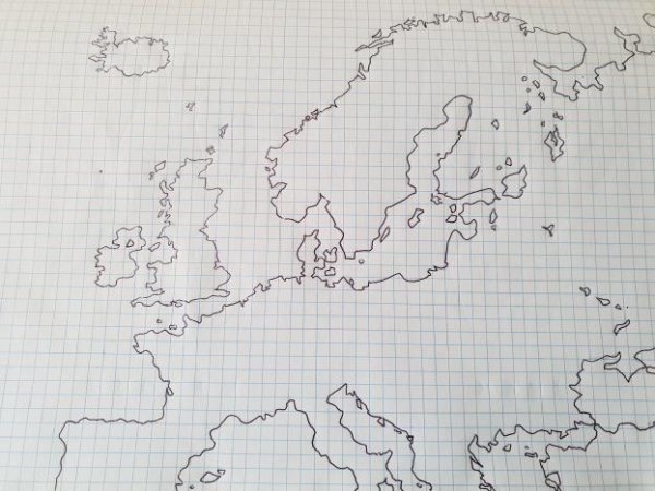
Hand-drawn map of Europe
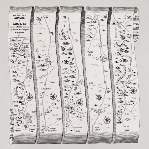
Ogilby style strip map of the route from Denver to Santa Fe
The Kabyle People (Berber/Amazigh)

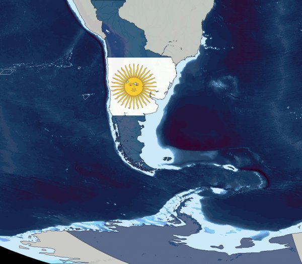
The historical revisionists of Argentina believe that Argentina should be bigger and use other colors in the flag, this map shows this but adding Chile, an extra piece of Antarctica based on the meridian of Rapa Nui, the South of Brazil and the territory called "Litoral" which had to be from Charcas