Looks like I've been caught

Like
Comment
Share
Looks like I've been caught


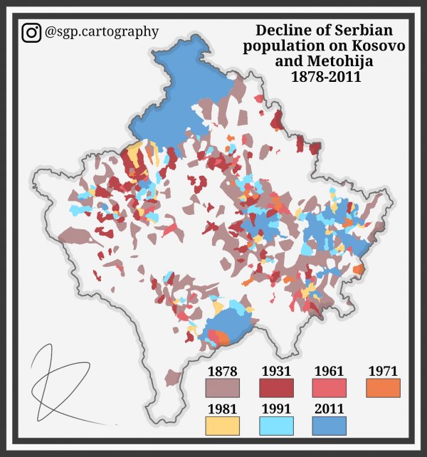
Decline of Serbian population on Kosovo and Metohija 1878-2011
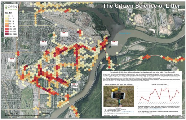
Litter Data of Prince George, BC using the openlittermap.com database. Cartography by Frank Ogiamien, 2022
I made a fun little map of a made up scenario.
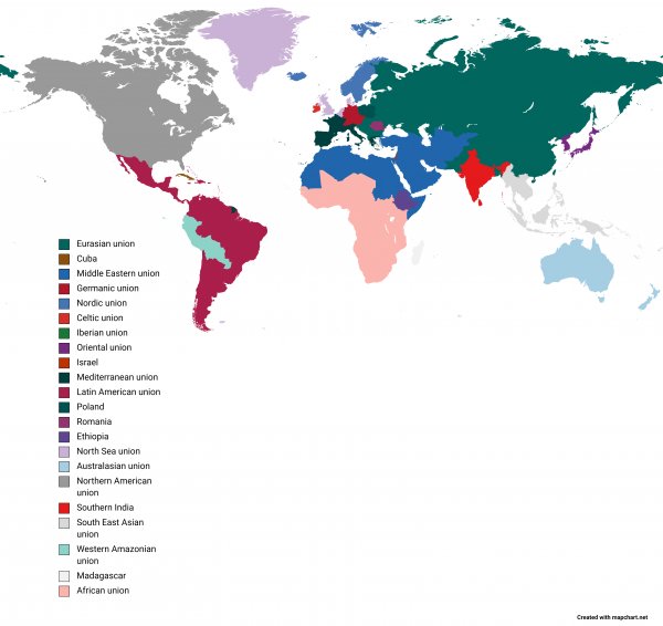
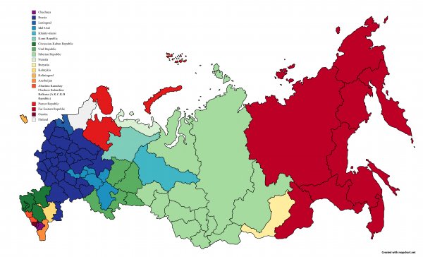
Map of the potential extreme dissolution of Russia
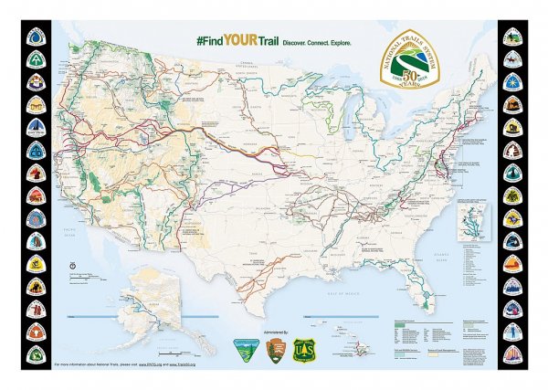
US National Trail System. Includes National Scenic Trails (like Appalachian Trail and Pacific Crest Trail) as well as National Historic Trails (like the Oregon Trail, Trail of Tears, and Iditarod).
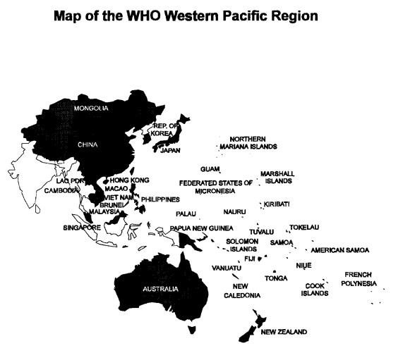
Map of the Western Pacific region (World Health Organization, 1995)
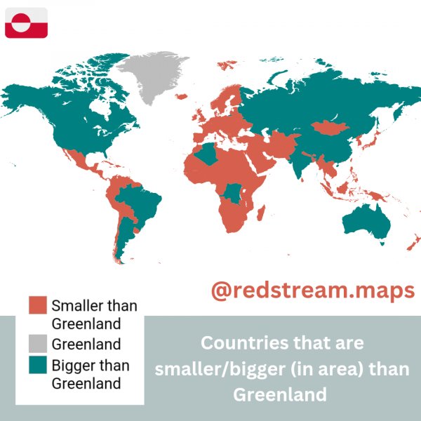
Countries that are smaller/bigger than Greenland
What about it?
Source: Classified
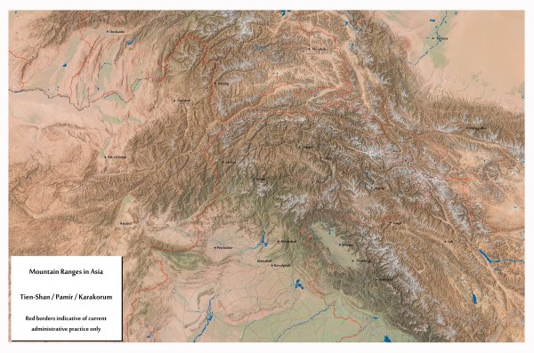
South Central Asian Mountain ranges
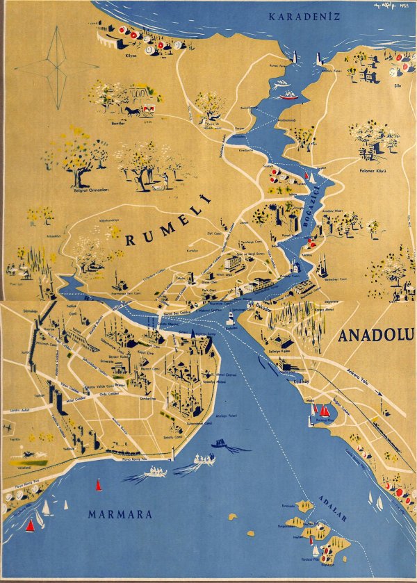
Touristic Istanbul map drawn in the 1950s
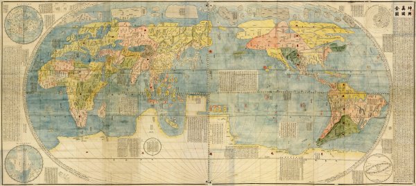
Copy of the "Map of Ten Thousand Countries" drawn by the Jesuit Mateo Ricci for the Chinese emperor (1602)