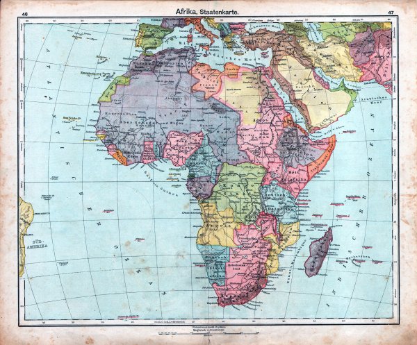
Colonial Africa (🇩🇪 map from the 1910s)
Like
Comment
Share
Colonial Africa (🇩🇪 map from the 1910s)


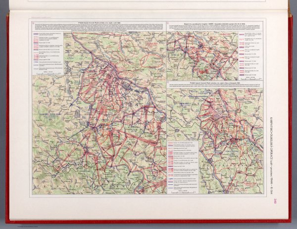
Part II: Carpathian-Dukla operation September - December 1944 - Czechoslovakian military atlas (1965) (84th of this series)
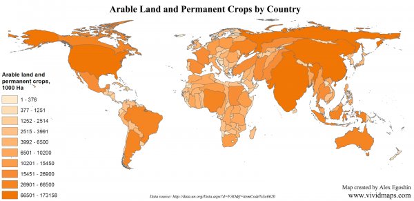
Size of a country by the amount of arable land
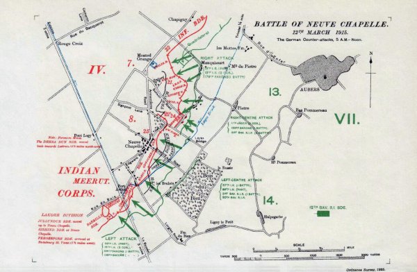
Battle of the Neuve Chapelle on March 12, 1915, German counterattacks. Map of trenches (1925)
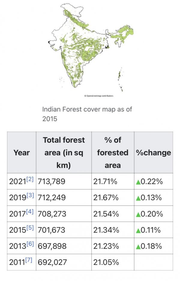
Forest Cover increase in India
What about it?
Active afforestation projects have helped overall forest cover increase.
Due to a massive need of industrial output, large areas were converted from green to concrete over the years, so to counter it the centralised 30 year plan is on the way to make India green again.
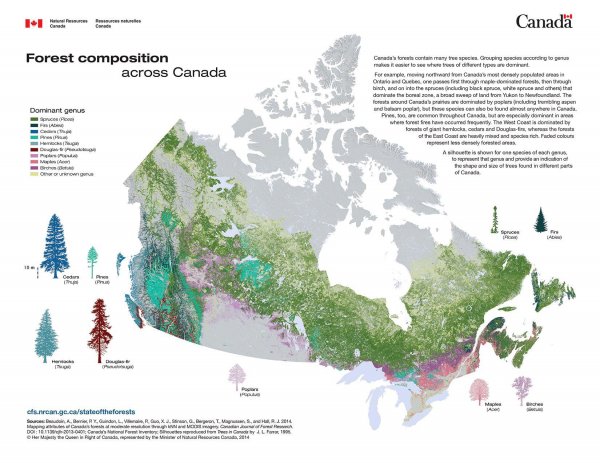
Forest composition across Canada
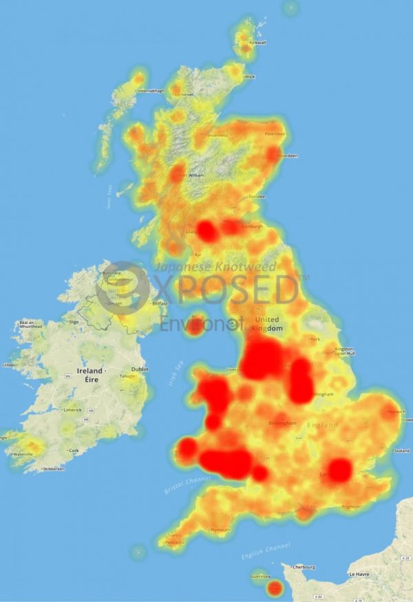
'Heat map' of prevalance of infestation of the extreme pest-plant *Japanese Knotweed* across the British Isles.
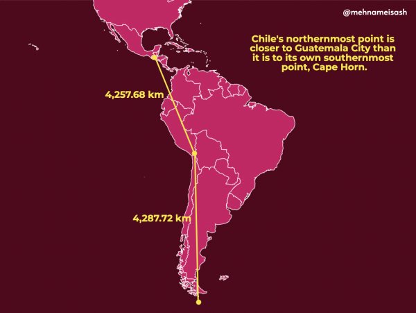
True size (or length?) of Chile, north to south
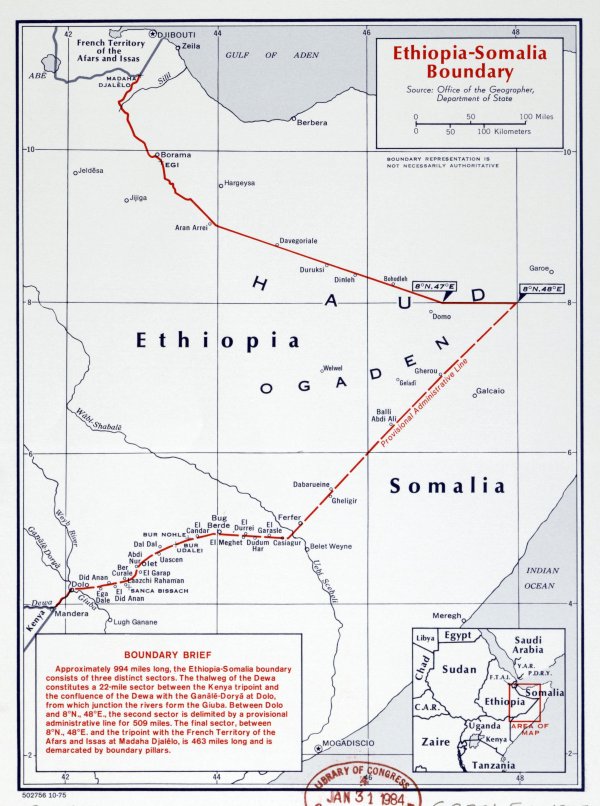
Ethiopia-Somalia 'Provisional Administrive Line', a compromise between Ethiopia and Somalia border claims
Flagmap of Communities + Brussels-Capital Region of Belgium
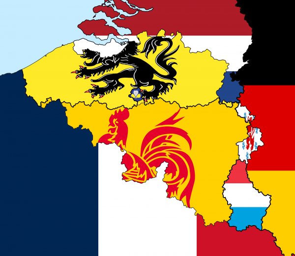
Linguistic flagmap of Belgium