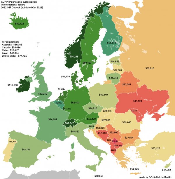
GDP per capita
Like
Comment
Share
GDP per capita


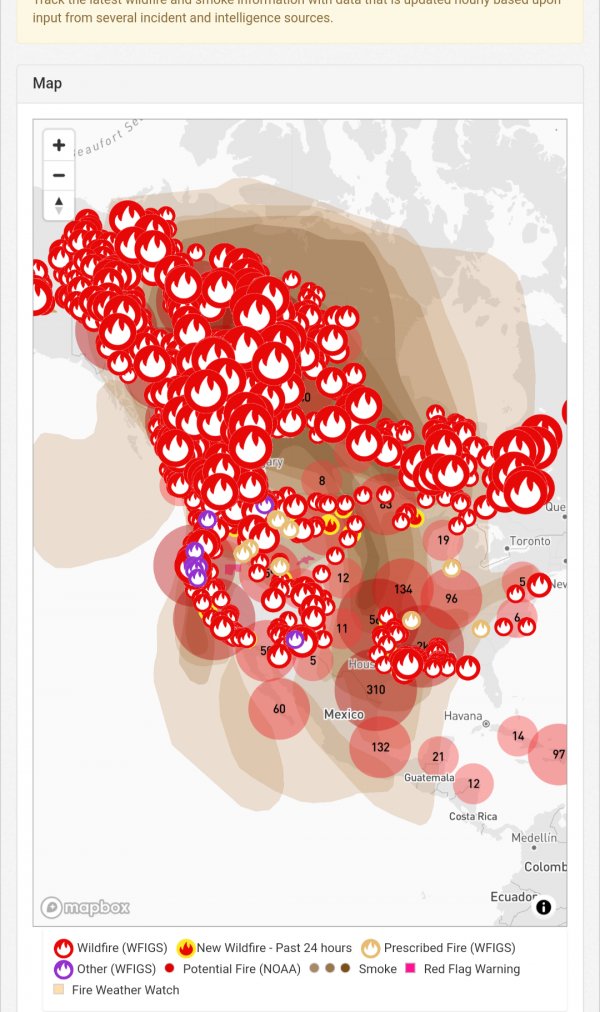
wildfire, smoke map: Track latest wildfires, red flag warnings
Link <https://data.thetimesherald.com/fires/>
Not sure anyone posted wildfire maps with the air quality of each state. I know it's hard to look at without zooming I posted the link so you take a look yourself. When you click on the symbols tells you info of that fire 🔥. It could get worse depending on the weather.
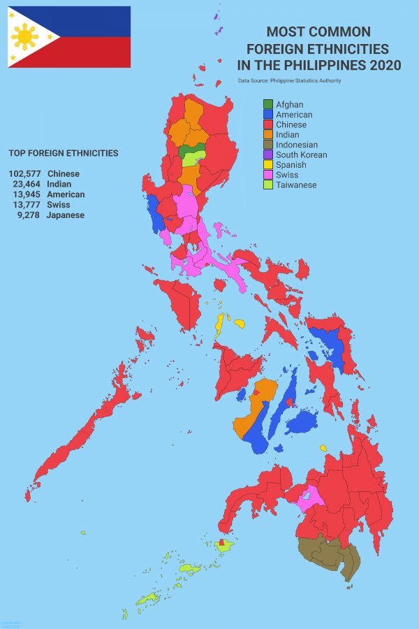
Most Common Foreign Ethnicities in the Philippines 2020
Corrected Map. Thanks!
Data Source: Philippine Statistics Authority Census of Population and Housing 2020
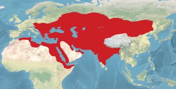
Map of All Lands Once Ruled By Turkic Empires.
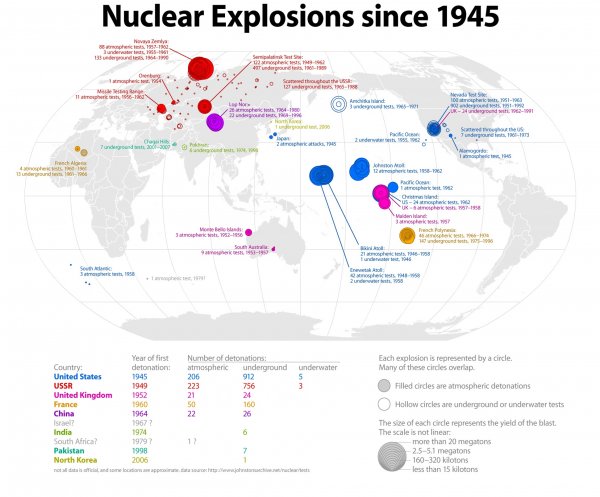
Nuclear explosions since 1945.
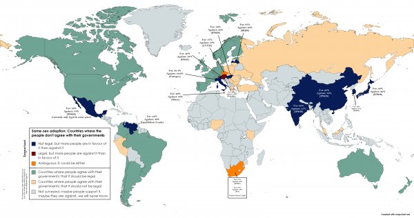
Same sex adoption 👪: Countries where people don't agree with their government (Source: Wikipedia | Societal attitudes towards homosexuality : Adoption)
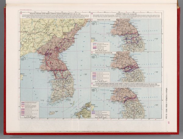
The Korean Civil war in 1950-1953. Part II - Czechoslovakian military atlas (1965) (102nd in this series)
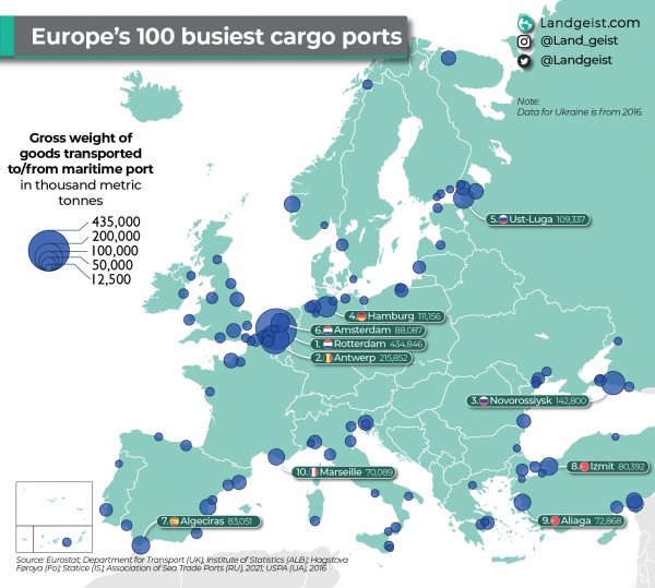
Europe's 100 busiest maritime cargo ports
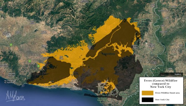
Evros (Thrace, Greece) Wildfire area compared with New York City
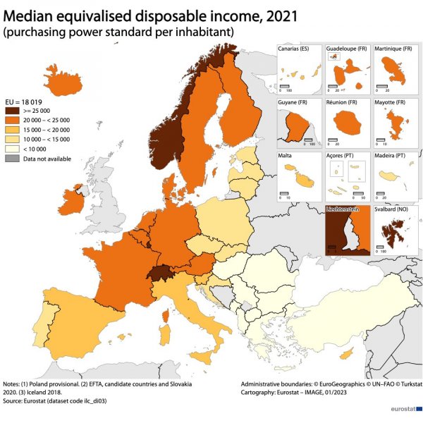
💰In 2021, the median disposable income was 18 019 PPS (purchasing power standard) per inhabitant in the EU.
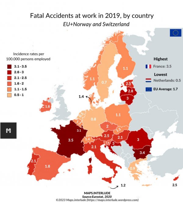
Fatal Accidents at work in 2019 in the EU, by country