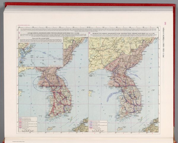
The Korean Civil war in 1950-1953. Part I - Czechoslovakian military atlas (1965) (101st in this series)
Like
Comment
Share
The Korean Civil war in 1950-1953. Part I - Czechoslovakian military atlas (1965) (101st in this series)


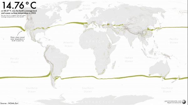
Visualising Earth's mean temperature - How close are you to our Planet's average temperature?
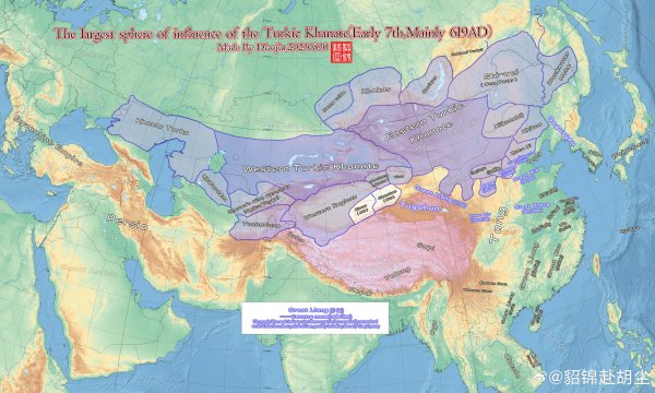
Eastern & Western Turkic Khanates (619AD)
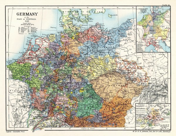
The HRE at the Treaty of Westphalia (1648)
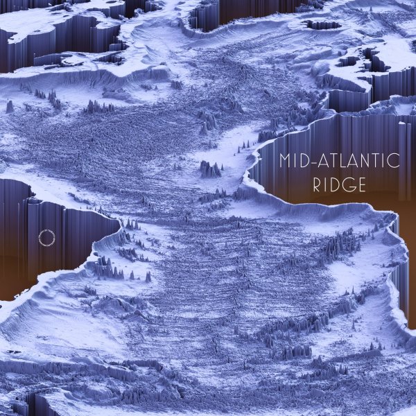
Mid-Atlantic Ridge
Source: https://twitter.com/researchremora
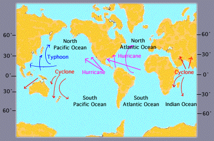
What do you call those big dangerous wind donuts?
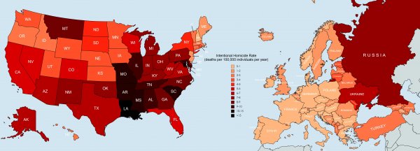
Intentional homicide rate in the EU vs. US. [OC by u/flyingcatwithhorns]
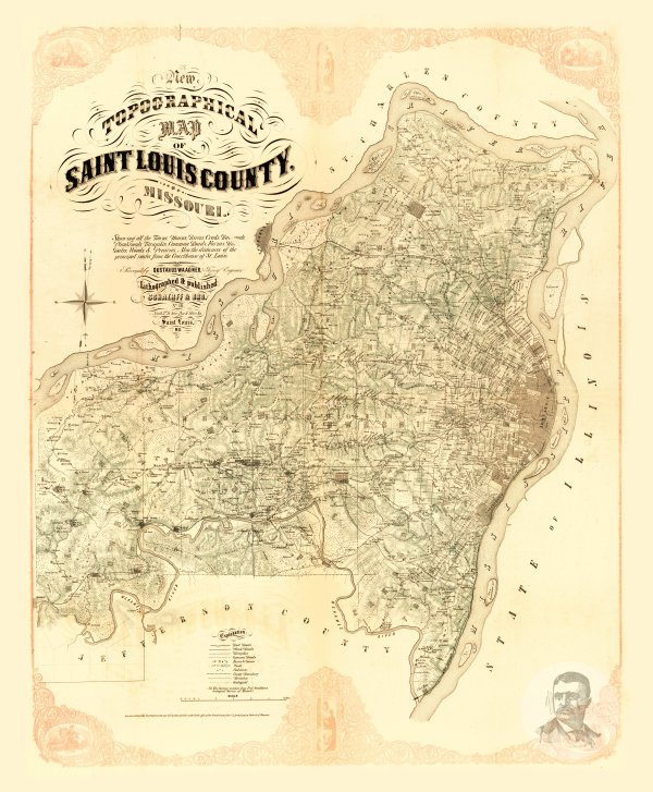
Saint Louis County, Missouri 1857 Map
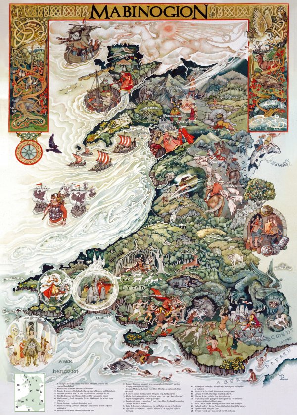
Mythical map of Wales,
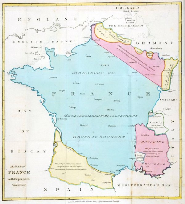
Divisions of France proposed in 1793 by William Playfair
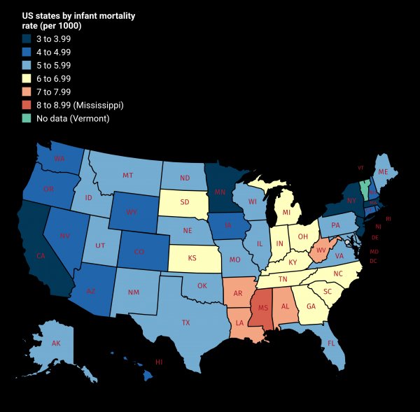
US states by infant mortality rate.