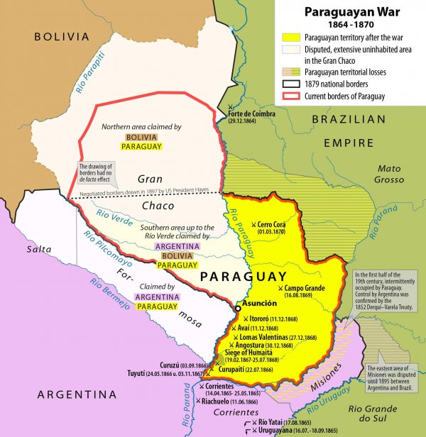
Map of the Paraguayan war, the greatest interstate war in the Americas, including the locations of the largest battles and territorial changes after the conflict
Like
Comment
Share
Map of the Paraguayan war, the greatest interstate war in the Americas, including the locations of the largest battles and territorial changes after the conflict


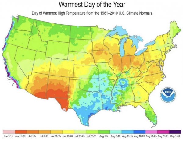
Warmest day of the year
Why is it so much hotter in August and September on the West coast?
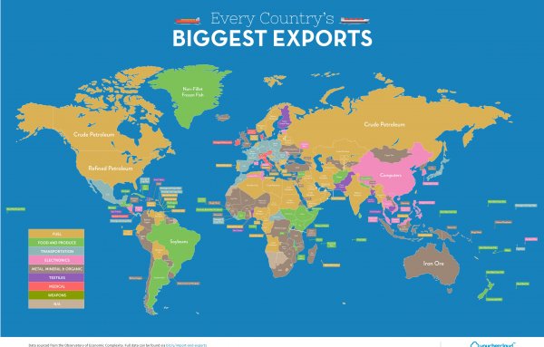
Map of every country's biggest export [4586×2935]
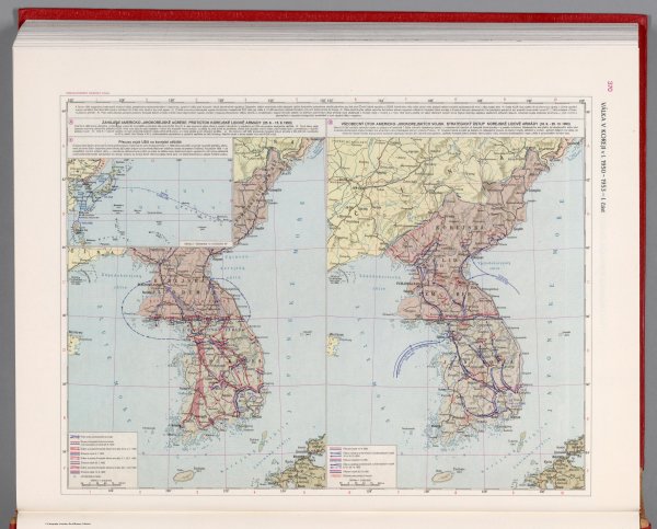
The Korean Civil war in 1950-1953. Part I - Czechoslovakian military atlas (1965) (101st in this series)
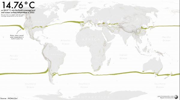
Visualising Earth's mean temperature - How close are you to our Planet's average temperature?
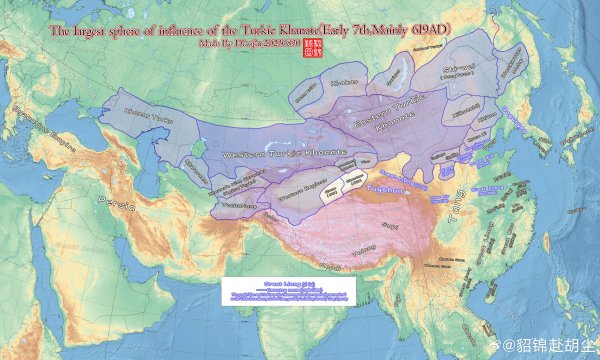
Eastern & Western Turkic Khanates (619AD)
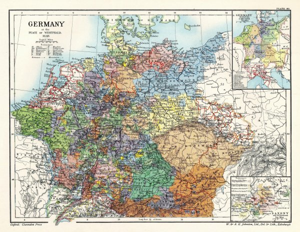
The HRE at the Treaty of Westphalia (1648)
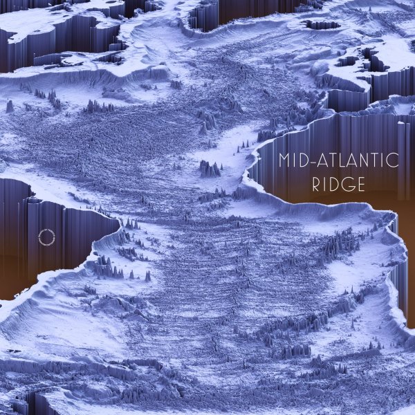
Mid-Atlantic Ridge
Source: https://twitter.com/researchremora
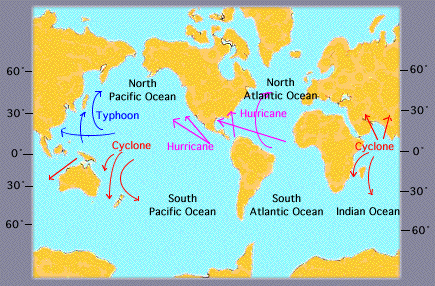
What do you call those big dangerous wind donuts?
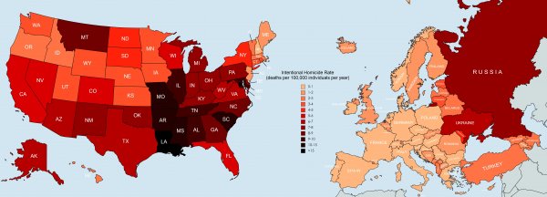
Intentional homicide rate in the EU vs. US. [OC by u/flyingcatwithhorns]
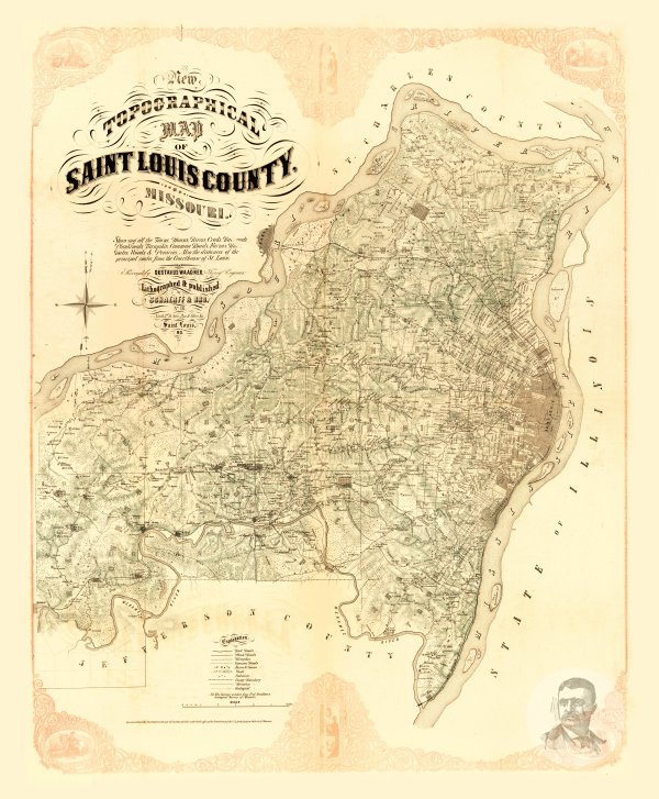
Saint Louis County, Missouri 1857 Map