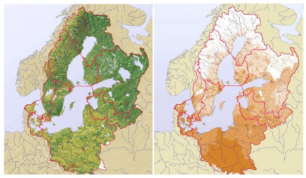
The Baltic Sea drainage basin. Land cover and population density
Like
Comment
Share
The Baltic Sea drainage basin. Land cover and population density


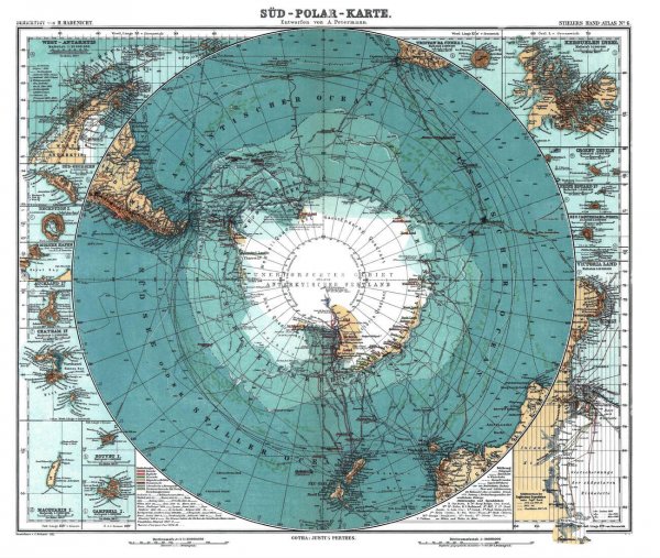
Antarctica, German map, 1910s
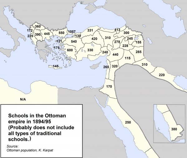
Schools in the Ottoman empire in 1894/95 (numbers could be incomplete)
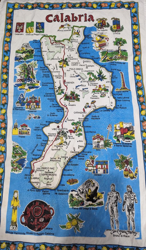
Souvenir Map of Calabria, Italy
This has been in my family for about 30 years. Unsure of who brought it back or which family member from over there brought it with them.
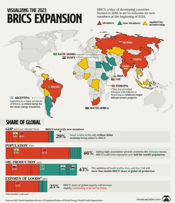
The recent BRICS expansion in terms of GDP, Population, Oil Production, and Good exports (source: visualcapitalist.com)
Countries where children are most satisfied with their lives

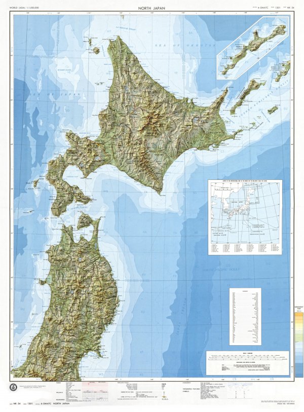
Topographic map of North Japan with shaded relief
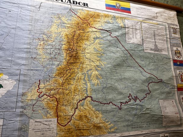
1960s Map of Ecuador
Spotted in Cuenca. Showing the border claimed by Ecuador until the 1990s.
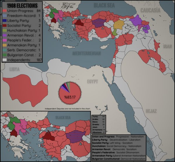
1908 Ottoman Parliament Deputies Elections - NOTE: Colored in the Color of the Party with the Most Deputies in the Sanjaks. Independent dyeings are valid for starboards that are not deputies with any party. Example; If X banner 1 Ittihad and Progress - 3 Independent, this banner is painted red.
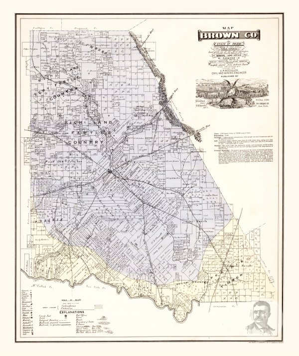
Brown County, Texas 1876 Map
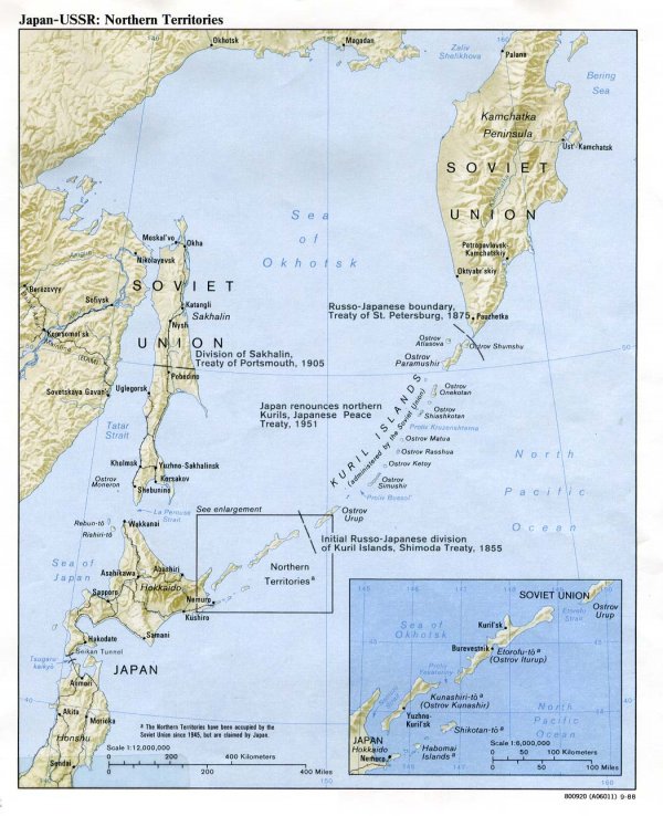
Japan-USSR: Northern Territories