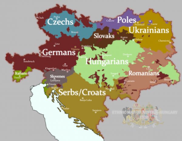
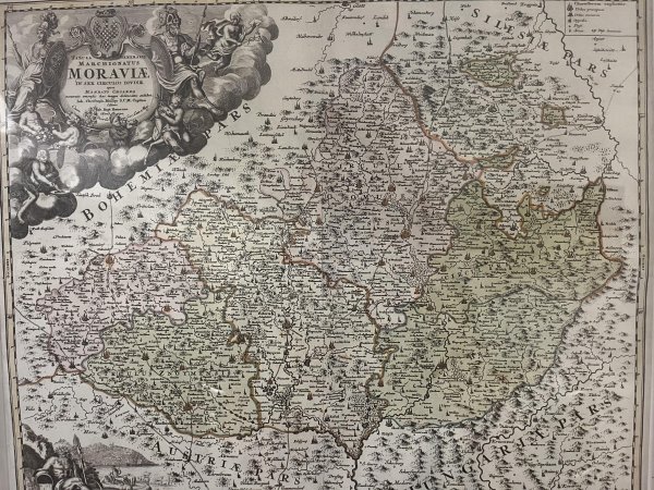
Can anyone date this map?

Found this in a small village of Ivaň in Moravia, Czech Republic. I wonder what year it can be from. I was thinking something before WW1 when Austria-Hungary was still around.

image
Read also:

The Great Loop is a continuous waterway that mariners can travel that includes part of the Atlantic, Gulf Intracoastal Waterways, the Great Lakes, Canadian Heritage Canals, and the inland rivers of America's heartland.

image

Real GDP Growth 2023 (IMF)

image

The "Staande Mastroute" ("Standing Mast Route") allows sailing boats with a mast up to 30 meters to cross the Netherlands from the German border to the south of Rotterdam. 37 drawbrigdes cross the route. Fees for bridges add up to 13 € which are paid in cash using wooden shoes on fishing rods.

image

Historic vs present range of the African Lion (Panthera leo)

image

A very detailed map of the ethnic groups of Austria-Hungary (1910 census)

image

How big is Indonesia? Its territory as long as a distance from USA and Europe.

image

The world's population compared to India

image

Military pacts and treaties, the capitalist state - Czechoslovakian military atlas (1965) (105th in this series)

image

Florida map I made in Inkarnate

image

Countries that have red on their flags [2622x1153]

image