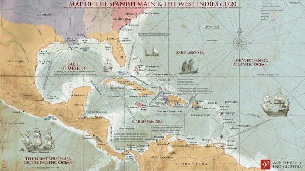
caribbean map 1720
Like
Comment
Share
caribbean map 1720


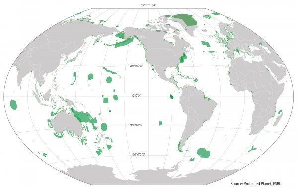
Global marine protected areas
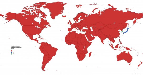
Windows directory separator around the world
Google Street view coverage 2023
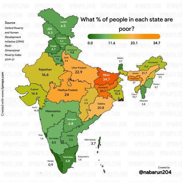
What percentage of people in each Indian state are poor? (Newer data from 2019-21, the other map on the sub is from 2015)
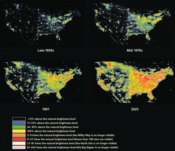
Light Pollution Map of the United States
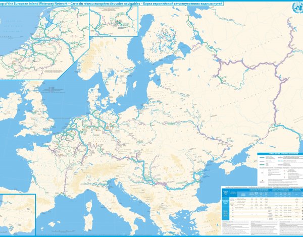
Detailed map of navigable inland waterways of Europe, 2012 [7592x5956]
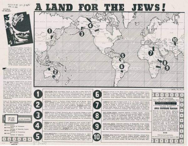
Proposals for a Jewish National State (circa 1945)
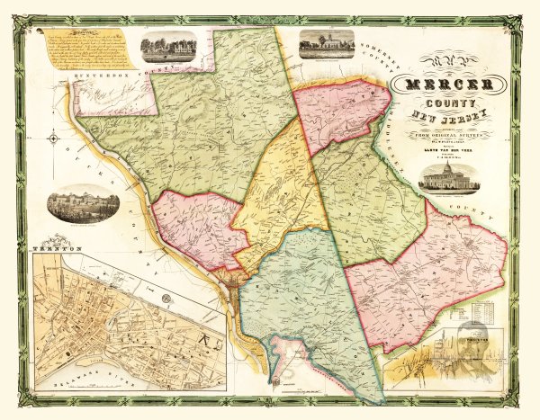
Mercer County, New Jersey 1849 Map
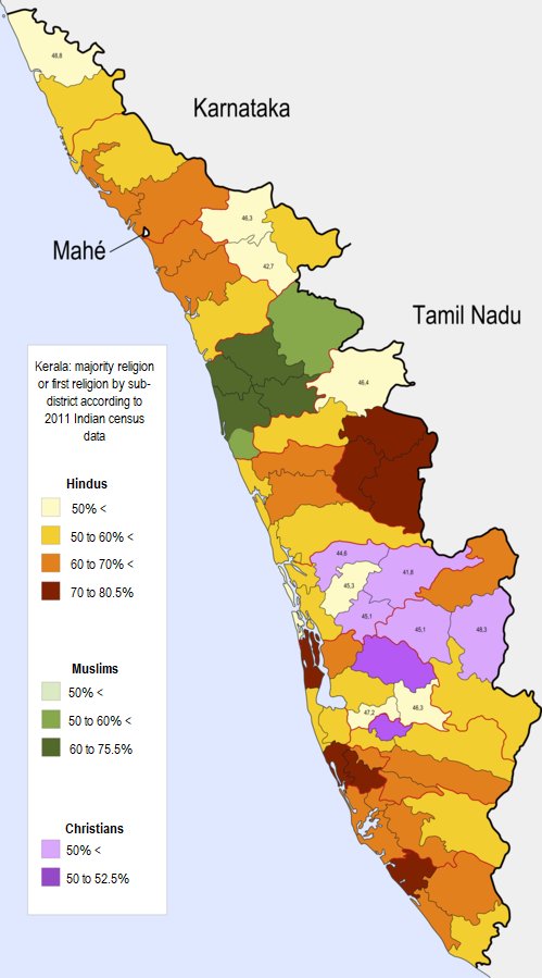
Majority or plurality religion by sub-districts in the state of Kerala, India
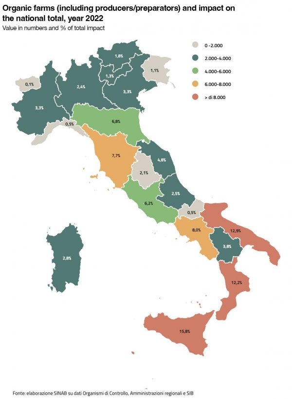
Italy's organic farms numbers and impact on the national total by region