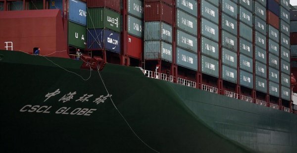
CSCL Globe, the world’s largest container ship next to some people
Like
Comment
Share
CSCL Globe, the world’s largest container ship next to some people


Under a foggy bridge.


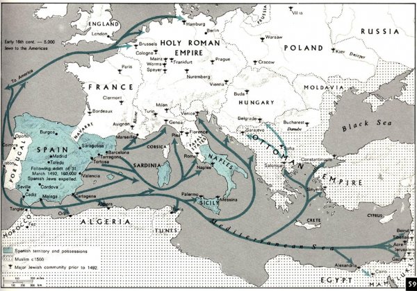
Paths of forced Jewish migration from the Iberian Peninsula and major Jewish communities in Europe prior to 1492
Banknote Map of Europe, circa 1990s

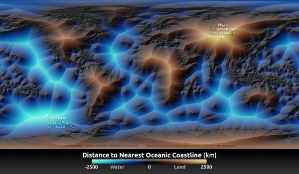
Colour-coded by minimum distance to a coastline, both for land *and* for ocean.
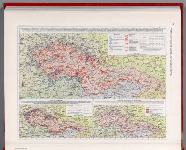
The military situation of Czechoslovakia during the Munich Agreement - Czechoslovakian military atlas (1965) (59th of this series)
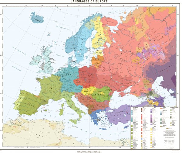
Languages of Europe - updated [3500x2937]
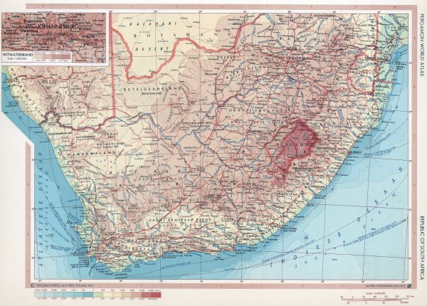
Topographic map of South Africa (1967)
Irish railway network in a century

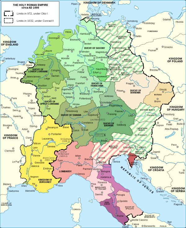
The Holy Roman Empire around the year 1000
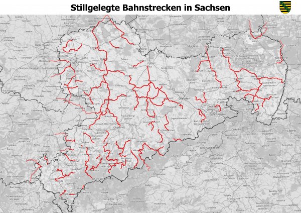
Closed down passenger railways in Saxony, Germany
What about it?
source: https://de.wikipedia.org/wiki/Liste_der_stillgelegten_Eisenbahnstrecken_in_Sachsen