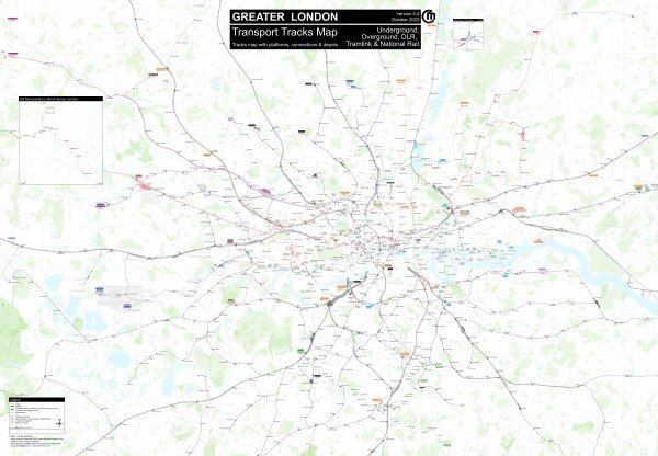
Detailed London rail map
Like
Comment
Share
Detailed London rail map


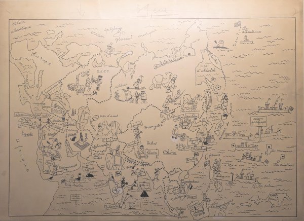
Map by Herge (Tintin)
Found this map in the Herge Museum which is drawn by Herge the author of Tintin. Gives a good look about the stereotypes that existed back in the days.
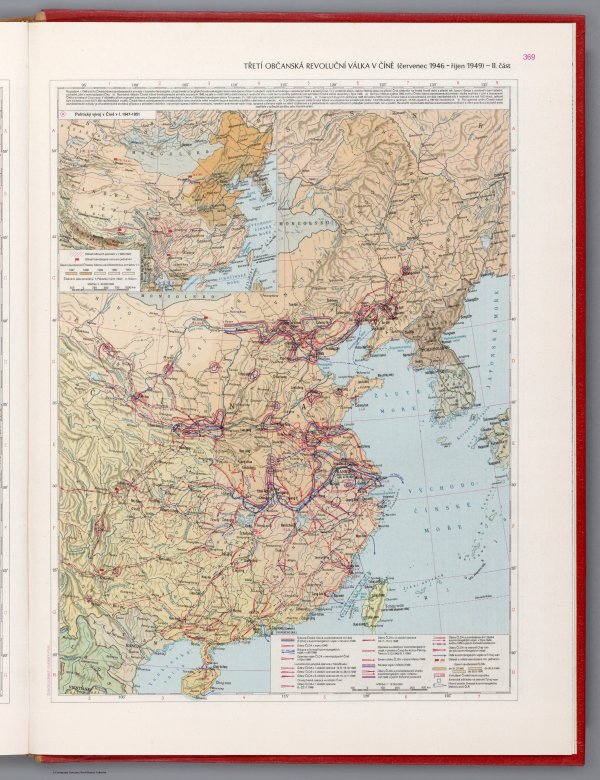
Part II: The Third Civil Revolutionary War in China (July 1946 - October 1949) - Czechoslovakian military atlas (1965) (100th in this series)
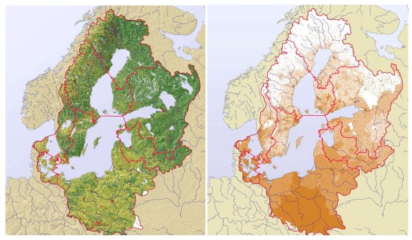
The Baltic Sea drainage basin. Land cover and population density
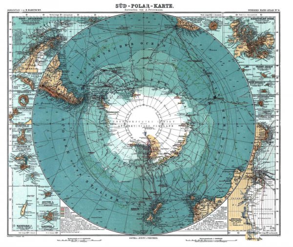
Antarctica, German map, 1910s
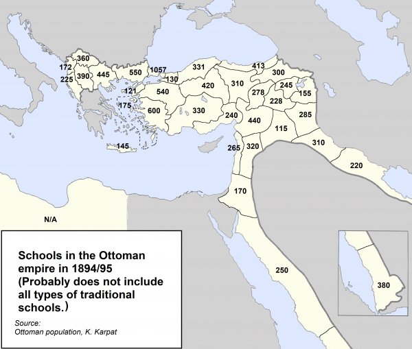
Schools in the Ottoman empire in 1894/95 (numbers could be incomplete)
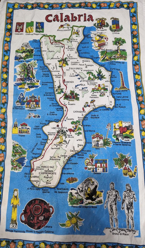
Souvenir Map of Calabria, Italy
This has been in my family for about 30 years. Unsure of who brought it back or which family member from over there brought it with them.
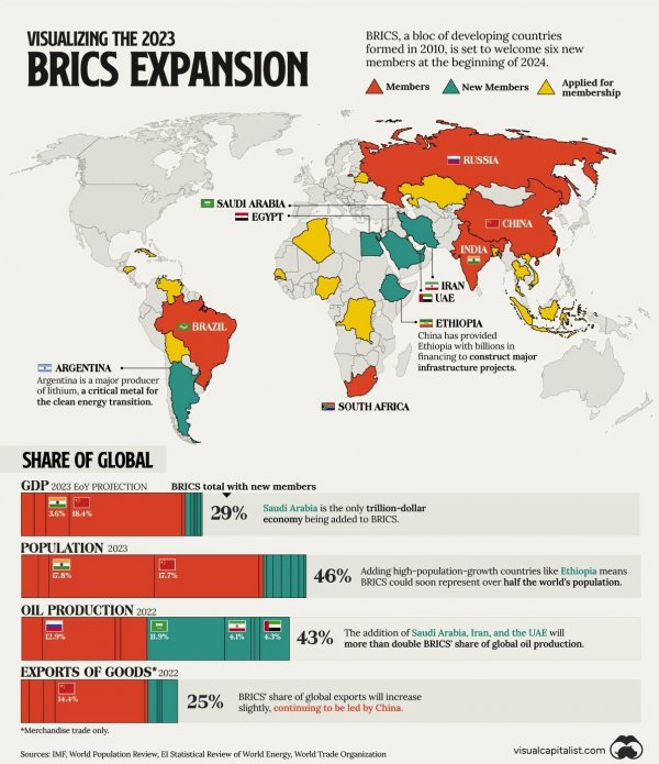
The recent BRICS expansion in terms of GDP, Population, Oil Production, and Good exports (source: visualcapitalist.com)
Countries where children are most satisfied with their lives

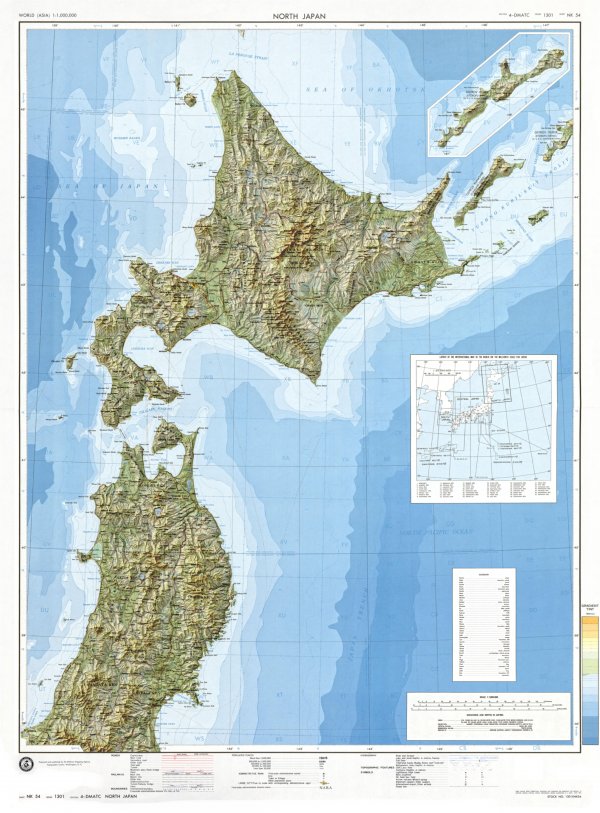
Topographic map of North Japan with shaded relief
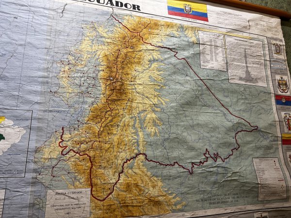
1960s Map of Ecuador
Spotted in Cuenca. Showing the border claimed by Ecuador until the 1990s.