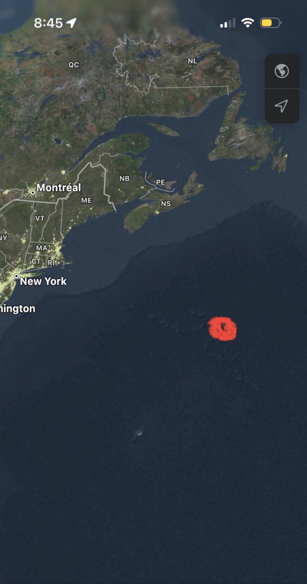
Imagine an island located here, describe its climate!

Imagine one of the New England seamounts were actually an island. Same latitude as southern New Jersey but as far away from the Eastern Seaboard as Bermuda. My take - similar climate to the Azores. Mild enough to support palms. Gulf Stream moderates the climate and makes it warmer than the Azores, potentially warm enough to support Coconut Palms. Perhaps home to the highest latitude Coconut Palms. Island gets incredibly amounts of rain, particularly in winter. Always on the warm side of Nor’easters bringing high temperatures into the 80’s even in January. Cold fronts are moderated by 600+ miles of warm Atlantic waters between it and the USA.

image
Read also:

Map of the bombs that were dropped on Laos by the US

image

How was this circular feature in coastal western Greenland formed?

image

World map where the Atlantic is split instead of the Pacific, flipped upside down, and area equally represented

image

Guess what era this population density map represents

image

Date this map/globe

I see people asking if this can be dated. Maybe this will help. something I saved and think is helpful. thx 2 u/khfftufu

image

Top Cities

Source: Business Insider

image

Is There A Reason Why Mongolia and Kazakhstan Don't Border?

image

Why are Romania and especially Bulgaria so low despite being in the EU for near 2 decades now?🤔

image

TIL the shortest distance between Nepal and Bangladesh is only 21-22 km

image

Saw this claiming that Greenland was not geographically part of North America. Is this true? Politically I understand it’s not but I thought geographically it was?

image