
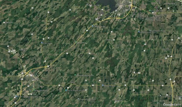
Why are these farmlands in south-east Wisconsin showing these diagonal direction lines?
Like
Comment
Share

Why are these farmlands in south-east Wisconsin showing these diagonal direction lines?


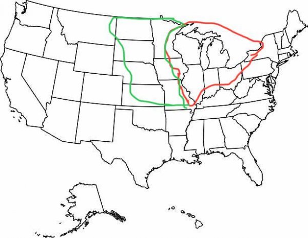
This sub seems to have a really skewed view of the Midwest: the red is the actual Midwest, the green is the part of the Great Plains that people seem to think is midwestern
The Midwest is the US’ industrial heartland, centered around the Great Lakes. No part of the Dakotas, Kansas, or Nebraska should ever be considered part of it. (Keep in mind the lines I drew are very rough and not exact boundaries though)
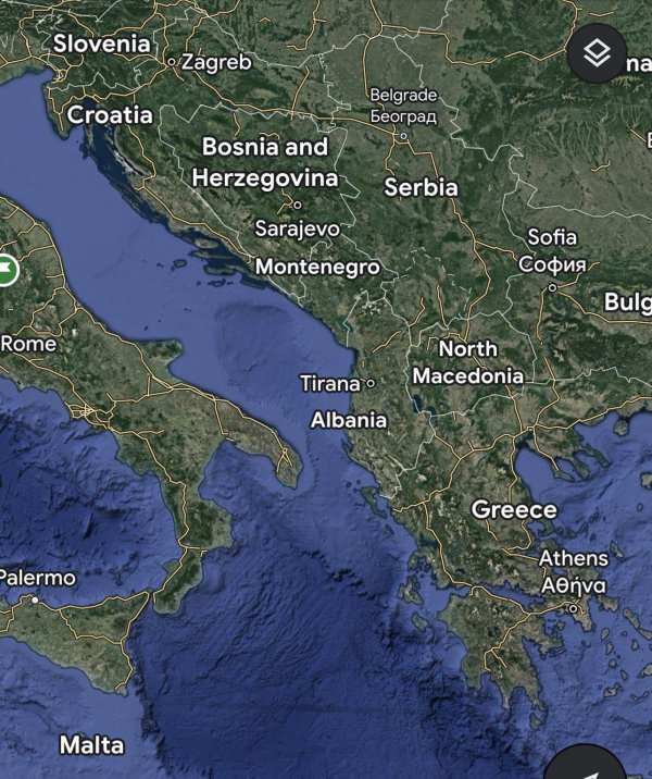
Why Albania has almost no islands compared to its neighbours?
Croatia, Bosnia and Greece coasts has lots of islands, but Albania and Monenegro coast seems to be empty. why is that?
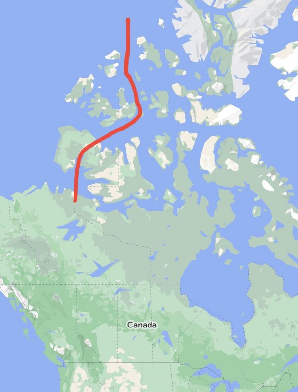
Why didn’t Canada draw a proper border between the islands of Yukon and NWT instead of a straight line?
Communist Countries
Source: @powerfullcountries (ig)
