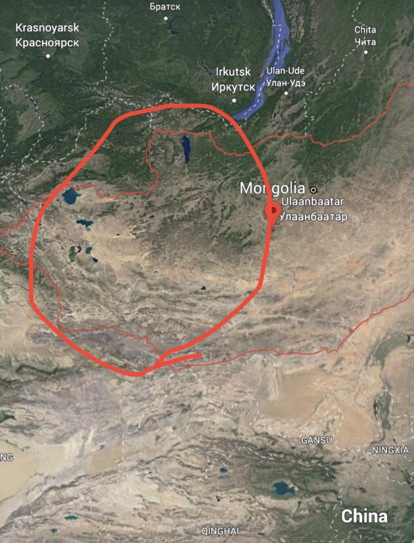
What goes on here in this part of Mongolia? I assume its very desolate
Like
Comment
Share
What goes on here in this part of Mongolia? I assume its very desolate


What’s unique about the region? What’s it’s outlook in 30 years?
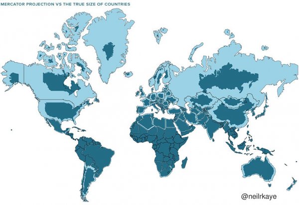
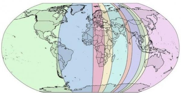
Why isn't it a bigger deal that the sizes of countries and continents are egregiously distorted on world maps? Why is a map this flawed accepted educationally?
Entire generations are growing up thinking Russia, Canada, Alaska, Greenland etc are all these mammoth masses of land that dwarf all others.
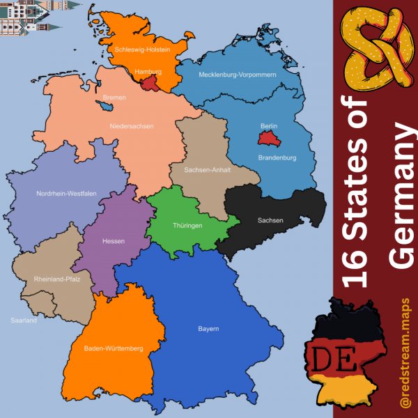
States of Germany
Anyone know what this undersea formation southwest of Ireland is or how it was formed?
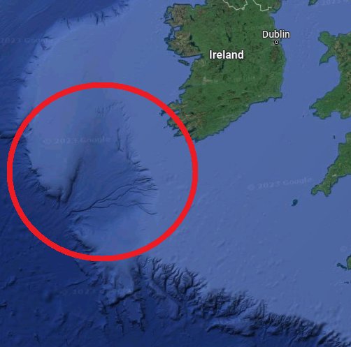
Probably the wrong sub
Please tell me where this is.
Thanks in advance.
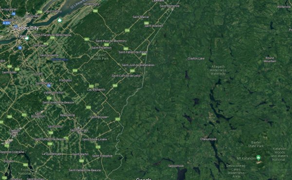
Why is the Quebec side of the border developed with farms and large towns, yet the Maine side is miles of empty wilderness?
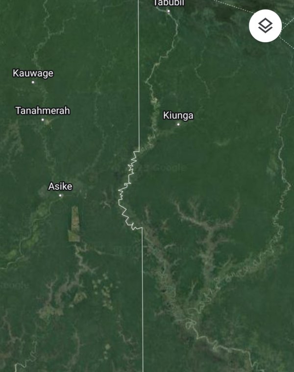
Why is this part of the Indonesia/Papua New Guinea border not straight?
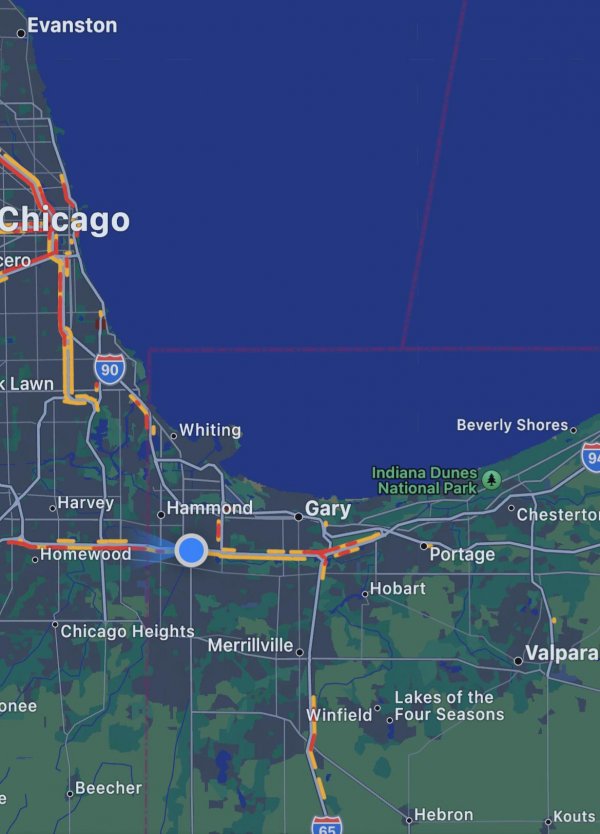
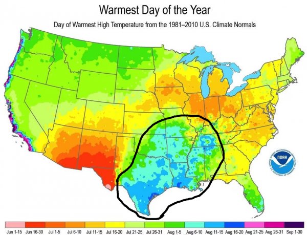
What is this part of the US called and why is it so hot?
Each slice of this map had an estimated 10% of the world population, but considering growth since this was made, the orange slice is likely more populated than the Westernmost.
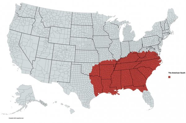
My interpretation of the American South