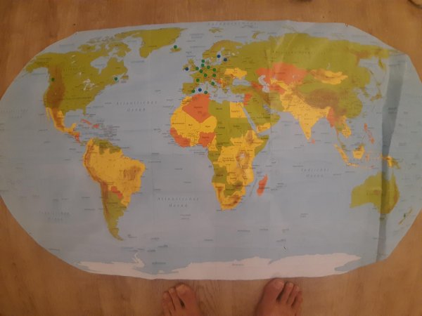
What do the colors represent?
The green and blue dots are not part of the map and were attached afterwards.
Like
Comment
Share
What do the colors represent?
The green and blue dots are not part of the map and were attached afterwards.


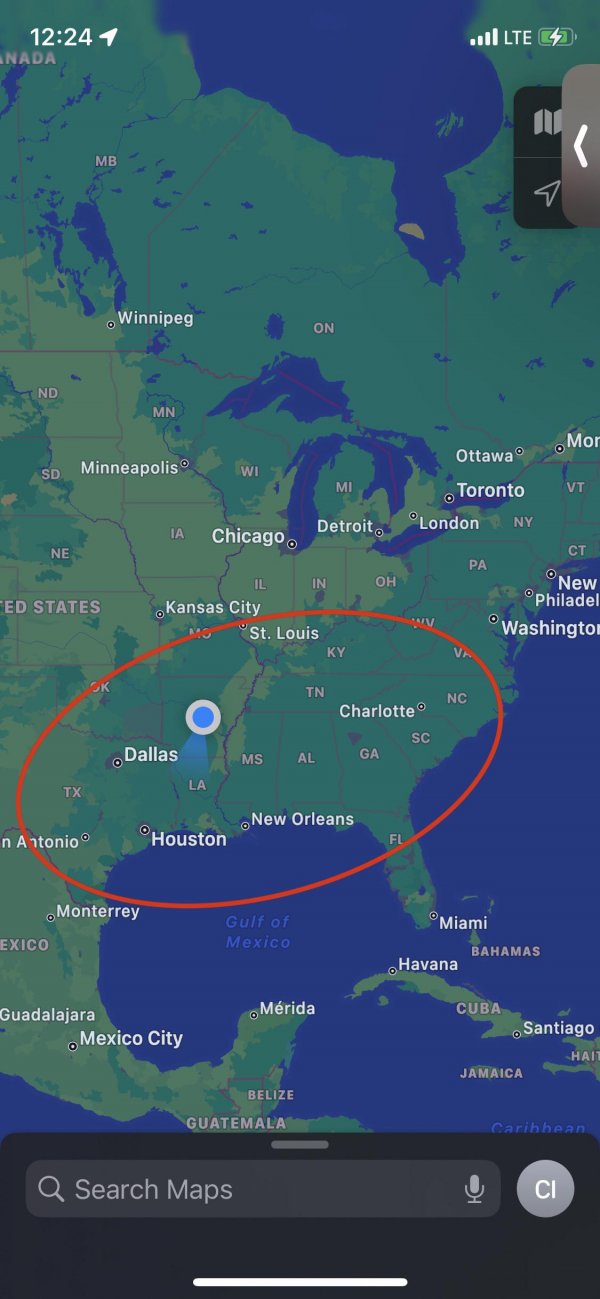
This is the cultural South
This is my opinion and is, of course, just a rough outline.
I’m interested in what others have to say.
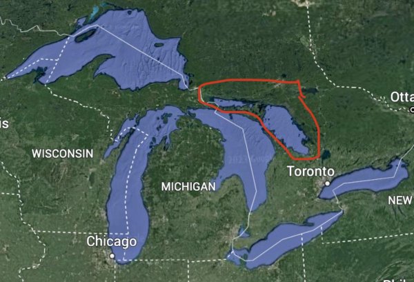
Why isn’t Georgian Bay considered to be a Great Lake?
I understand hydrologically it’s a part of Lake Huron, but the strait between Manitoulin Island and the Bruce Peninsula isn’t that much bigger than the Straits of Mackinac. Lake Michigan and Lake Huron are also both the same lake hydrologically too.
I feel like the proximity of the southern tip of Georgian Bay and Toronto has to be sort of important politically and logistically to Canadians? Plus this would give Canadians their own entire “Great Lakeâ€.
Also, this water is really just spill over from Lake Huron, Geologically speaking, the Great Lakes Basin is on the Michigan side of Wisconsin’s Door Peninsula and Ontario’s Bruce Peninsula, down to Niagara Falls.
What goes on here in this part of Mongolia? I assume its very desolate
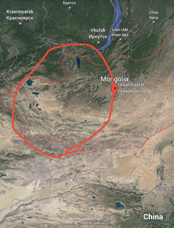
What’s unique about the region? What’s it’s outlook in 30 years?
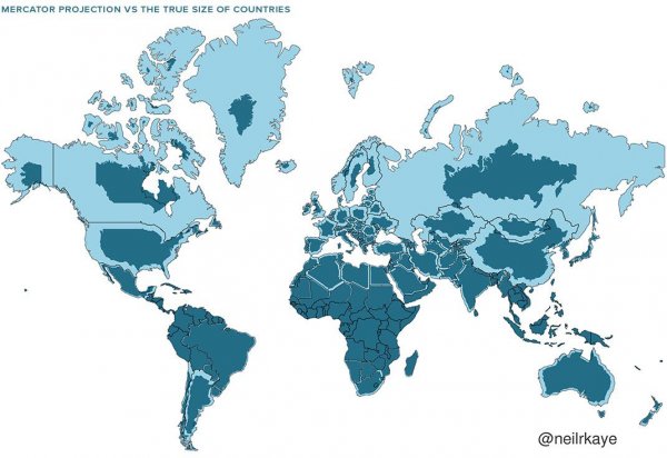
Why isn't it a bigger deal that the sizes of countries and continents are egregiously distorted on world maps? Why is a map this flawed accepted educationally?
Entire generations are growing up thinking Russia, Canada, Alaska, Greenland etc are all these mammoth masses of land that dwarf all others.
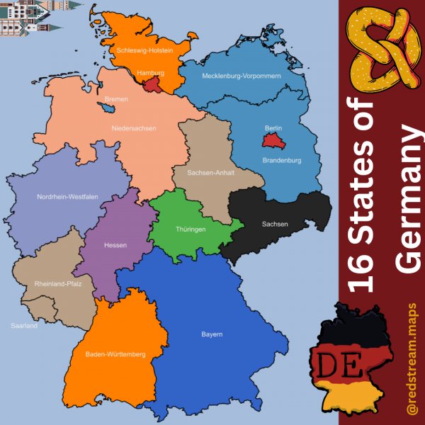
States of Germany
Anyone know what this undersea formation southwest of Ireland is or how it was formed?
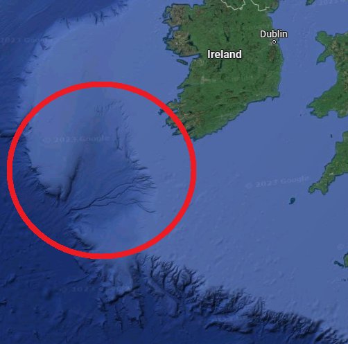
Probably the wrong sub
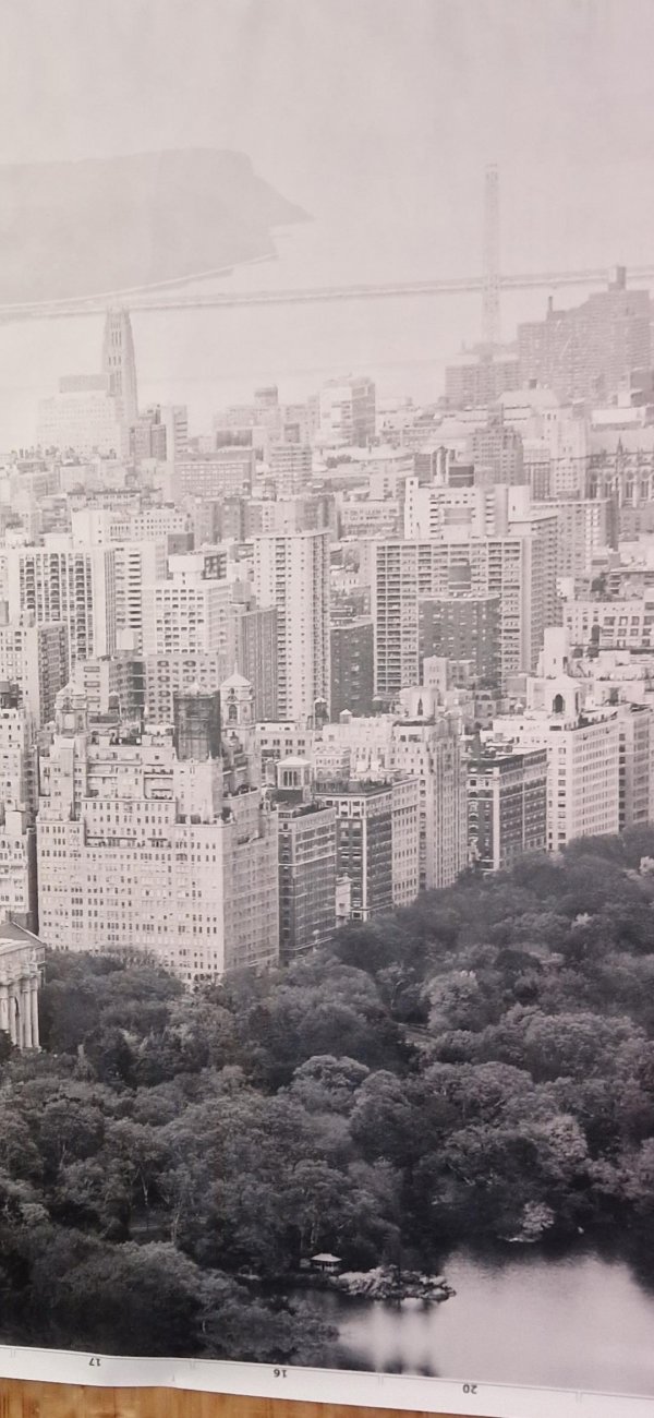
Please tell me where this is.
Thanks in advance.
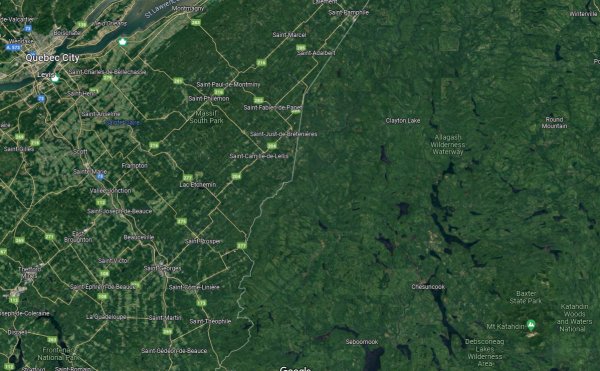
Why is the Quebec side of the border developed with farms and large towns, yet the Maine side is miles of empty wilderness?
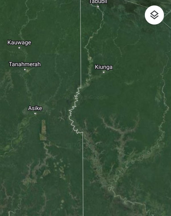
Why is this part of the Indonesia/Papua New Guinea border not straight?